Interactive Point Field Widget
Preview
Requirements
There is no requirements to use Leaflet open-source interactive map JavaScript library.
Key Features
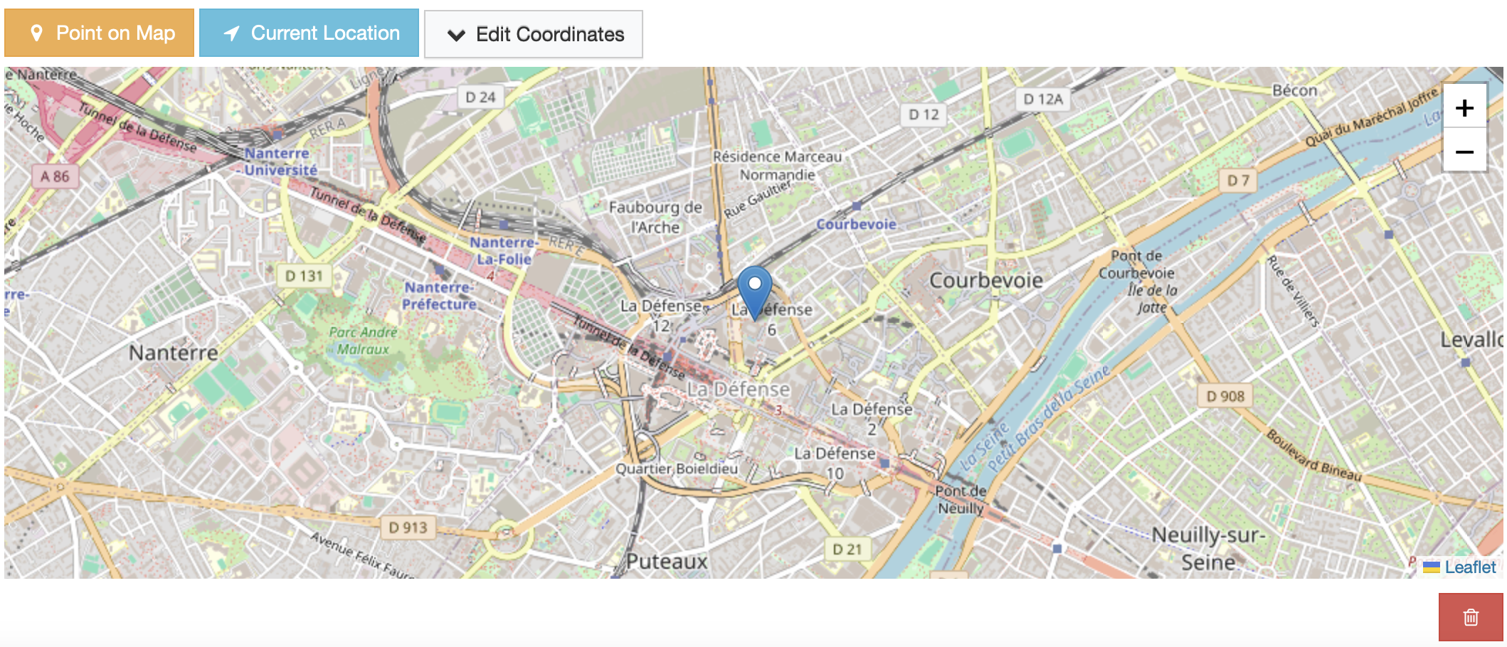
Use My Location Action: Users can set their current location as a marker using the “Use My Location” action button.
Edit Coordinates Inputs: The marker coordinates (latitude, longitude) can be updated manually through the Coordinates dropdown pop-up inputs.
Draggable Markers: Positioned markers can be dragged across the map, and the coordinates inputs will be updated when the marker is dropped.
Add Marker by Click: A marker can be added to the map via mouse click.
Settings
Default Settings
MAP_WIDGETS = {
    "Leaflet": {
        "PointField": {
            "mapOptions": {"zoom": 12, "scrollWheelZoom": False},
            "tileLayer": {
                "urlTemplate": "https://{s}.tile.openstreetmap.org/{z}/{x}/{y}.png",
                "options": {"maxZoom": 20},
            },
            "markerFitZoom": 14,
            "showZoomNavigation": True,
            "mapCenterLocation": get_default_center_coordinates(),
            }
        }
    }
}
mapOptions: Leaflet MapOptions settings can be managed using this dictionary. These settings are passed as arguments to Leaflet JS initialization function. Default values are provided for zoom, scrollWheelZoom.
tileLayer: TileLayer source configuration. (Do not override the default settings if you don’t serve the map tiles from different source
openstreetmap.org)markerFitZoom: A custom zoom value is set programmatically after a marker is added with user geolocation or place autocomplete so on. This setting exists to enhance the user experience. The default value is 14.
showZoomNavigation: Enable/Disable zoom in/out UI buttons on the map. Default is
TruemapCenterLocation: Enable zoom in/out UI buttons on the map. Default is
True
Note
More details about map widget settings usage can be found in the settings guide.
Note
If no settings are provided for the map center (mapCenterLocation), the map will automatically center based on the django project’s timezone setting. This feature ensures that the map displays an appropriate and relevant initial view.
For more details on timezone center coordinates, refer to the following resources:
Usage
In the Django project settings file, the MAP_WIDGETS dictionary should be defined to customize the default settings for map widgets.
MAP_WIDGETS = {
    "Leaflet": {
        "PointField": {
            "mapOptions": {"scrollWheelZoom": True},
            "showZoomNavigation": False,
        }
    }
}
Django Admin
Django Forms
Javascript Triggers
There is no jQuery event trigger support for this widget yet.